

A Lifetime of Recreation in Montana’s Island Ranges
Think Great Falls is all alone out on the Great Plains, far away from the mountains?
Look again.

You can clearly see the Little Belts, Big Belts, Adel, Highwoods mountain ranges and a slew of one-of-a-kind mountainous “buttes” from town, as well as the main “Front” of the Rocky Mountains and the Scapegoat and Bob Marshall wilderness areas from the busy 10th Avenue South commercial strip. On a clear day the tips of the Bearpaw and Sweetgrass Hills peek over the northern horizons.
The ranges to the east and south of Great Falls are known as “Island” mountain ranges, mostly inactive volcanic remnants, within a half-hour to an hour’s drive.
They are isolated from each other and seem to float out there on the plains like islands.

But, don’t think these are small and boring.
Take the Little Belts range, which is anything but little, almost 1 million acres in size, nearly as large as the more famous Glacier National Park. Mostly in the Helena-Lewis and Clark National Forest, it is the largest of the “islands,” sprawling toward Stanford, Geyser, Belt, White Sulphur Springs and Judith Gap.
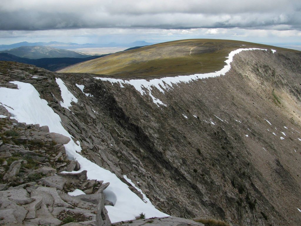
Its highest peak, Big Baldy, rises to over 9,000 feet and there are trout-bearing alpine lakes at its foot. Its often snow-capped and domed-top towers in the distance and is a striking monarch to travelers approaching Great Falls from the north on I-15.
The Little Belts range is a Great Falls playground that support elk, deer, mountain lions, lynx, black bear, and mountain goats. A grizzly was recently photographed there. This is historic wolf range, too.
The Little Belts are bounded by U.S. 87 on the north, Montana 3 on the east, U.S. 12 on the south and the famous blue-ribbon trout stream, the Smith River, on the west. U.S. 89 bisects the range, passing through old mining towns of Monarch and Neihart on the way to White Sulphur, a route designated a Montana “Scenic Byway.” At its high point is the family-owned and operated Showdown Ski Area. The Forest Service’s Belt Creek Ranger station is located between Monarch and Neihart on U.S. 89.
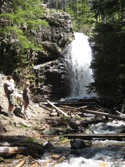
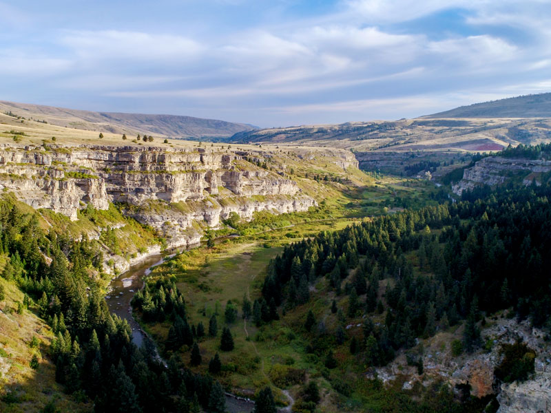
This by-way offers access along the way to good hiking in the limestone cliffs of Sluice Boxes State Park on Belt Creek, 30 miles from Great Falls, and Memorial Falls, a third-of-a-mile hike one-mile south of Neihart. Stop at the Sluice Boxes overlook to admire the cliffs and plan your next trip.

If you’re into ghost towns there are Barker and Hughesville east of Monarch on the Dry Fork Road, with old gold, silver, and lead workings still standing.

Caving? This is limestone country and the rock is shot through with caves. Lick Creek Cave on the road to Logging Creek has been fully explored.
In the winter there are back country ski and snowshoe trails at the top of Kings Hill Pass adjacent to Showdown and nearby is a major winter recreation complex used by cross country skiers and shoers (Silvercrest), dog-sledders, and snowmobilers.
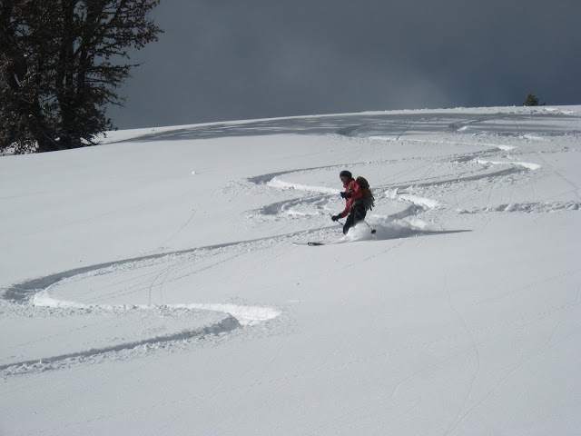
There are some 300 miles of snowmobile trails in the Little Belts, many of them groomed. The Little Belts is a prime hunting ground and is heavily used by motorcycles and quads.
The rustic cabin at King’s Hill Pass may be rented from the Forest Service. There are three Forest Service campgrounds along U.S. 89, Aspen Grove, Kings Hill, and Many Pines.
There’s a lifetime of recreation in this island range alone.
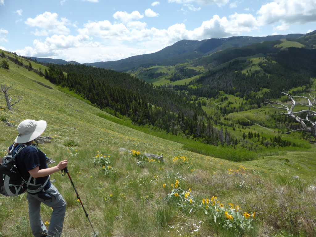
There are many recreational access points from U.S. 87 as well. I’d highly recommend the good gravel South Fork Judith Road accessed from Utica or Hobson into the area where cowboy artist Charlie Russell first came to Montana from St. Louis, and the Dry Wolf Road access south of Stanford. There’s even a wilderness study area known as the Middle Fork of the Judith River.

This mountain range has grown so popular that an organization of wide-ranging and sometimes conflicting interests has formed to reach consensus on its land use —- the Friends of the Little Belts — that has a Facebook page.
Tom Kotynski is the author of, “Discovering the Rocky Mountain Front.” He is a writer, a teacher, and an avid outdoorsman. Toms skill sets were sharpened during 36 years of daily newspaper work (Great Falls Tribune, USA-Today, The Times (a Chicago suburban daily)) and nine years in education as director of GFPS career and technical ed programs, and adjunct professor at UGF (now Providence) and Great Falls College. He taught writing, humanities and philosophy. Now retired, you can find Tom exploring the back country of Montana. His blog outtherewithTom.com hosts an extensive database of Montana adventure information.